The Opportunity Atlas is an interactive data tool that visualizes and spatializes children’s outcomes in the U.S., defined by a slew of metrics, in their adulthood. To test out this tool, I zoomed in on my hometown Hixson, TN to see how children who grew up there fared later in life. For example, children from Hixson, TN who grew up in the poorest of households are likely to see little income mobility, though they fare better than their counterparts in neighboring census tract.
The project aims to bring to life the multitude of factors that determine socio-economic mobility in the U.S. The tool allows users to test their own assumptions on income inequality, race, gender, place and space in the land of eternal promise. The Atlas draws on anonymized U.S. Decennial Census data from 2000 and 2010, Federal income tax return data, and the American Communities Surveys (ACS) data from 2005-2015 all combined to create one large dataset covering nearly the entire U.S. population.
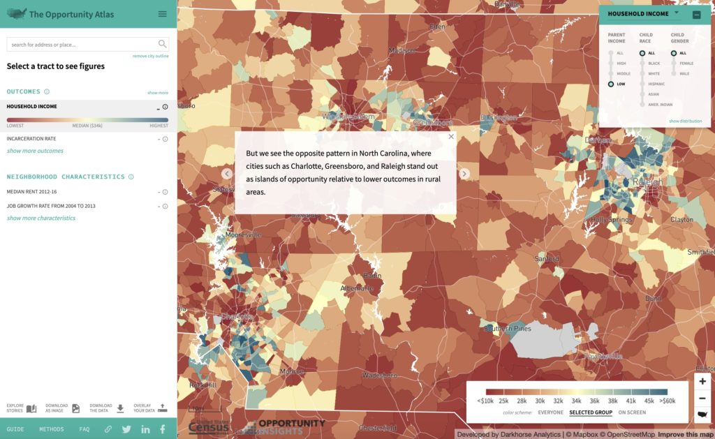
The Atlas is accessible to the general public, but complex enough to appeal to social science students and scholars. Users can select pre-made stories to explore specific topics such as the effect of moving from one neighborhood to another in Chicago. Those interested in using the tool to answer their own questions can customize the map using panels to select outcomes of interest and neighborhood and demographic characteristics. Data can also be downloaded for those seeking to conduct their own research.
The Atlas, at large, is quite effective in achieving its goal. Aesthetically, the maps are pleasing with census tracts painted in pleasant pastels. The pre-made stories walk novice users through a series of maps and graphs that answer address issues faced by cities like Chicago and Detroit, using data to draw insights on complex urban issues such as the neighborhood effect. The tool assumes a basic proficiency with statistics and can be difficult to use beyond its basic offerings.